
![Czech version of the Sudety / Sudeten map
Nr.
German
Czech
RNr.
Polish
RNr.
Commons category
de:Westsudeten
cs:Krkonošská oblast/Zapadní Sudety
pl:Pogórze Zachodniosudeckie
332.2
Western Sudetes
Pogórze Zachodniosudeckie
pl:Sudety Zachodnie
332.3
Sudety Zachodnie
1
de:Westlausitzer Hügel- und Bergland
cs:Západolužická pahorkatina a vrchovina
–
pl:Pogórze Zachodniołużyckie
332.21
Westlausitzer Hügel- und Bergland
2
de:Oberlausitzer Gefilde
cs:Lužická niva
–
pl:Płaskowyż Budziszyński
332.22
Oberlausitzer Gefilde
3
de:Lausitzer BerglandSchluckenauer Hügelland
cs:Šluknovská pahorkatina
IVA-1
pl:Pogórze Łużyckie
332.24
Šluknovská pahorkatina
4
de:Östliche Oberlausitz
?
–
pl:Pogórze Wschodniołużyckie
332.23
Östliche Oberlausitz
de:Zittauer Becken
cs:Žitavská pánev
IVA-4
pl:Kotlina Żytawska
332.25
Žitavská pánev
pl:Kotlina Liberecka
332.33
5
de:Lausitzer Gebirge(einschl. de:Zittauer Gebirge)
cs:Lužické hory(Žitavské hory)
IVA-20
pl:Góry Łużyckie
332.310
Lusatian Mountains(Zittau Mountains)
6
de:Isergebirgs-Vorland
cs:Frýdlantská pahorkatina
IVA-5
pl:Pogórze Izerskie
332.26
Frýdlantská pahorkatinaPogórze Izerskie
7
de:Isergebirge
cs:Jizerské hory
IVA-6
pl:Góry Izerskie
332.34
Jizera Mountains
8
de:Jeschken-Kosakow-Kamm
cs:Ještědsko-kozákovský hřbet
IVA-3
pl:Grzbiet Jesztiedzki
332.32
Ještědsko-kozákovský hřbet
9
de:Bober-Katzbach-Vorgebirge
cs:Kačavské podhůří
–
pl:Pogórze Kaczawskie
332.27
Pogórze Kaczawskie
10
de:Bober-Katzbach-Gebirge
cs:Kačavské hory
–
pl:Góry Kaczawskie
332.35
Góry Kaczawskie
11
de:Hirschberger Tal
cs:Jelenohorská kotlina
–
pl:Kotlina Jeleniogórska
332.36
Kotlina Jeleniogórska
12
de:Landeshuter Kamm
cs:Janovické rudohoří
–
pl:Rudawy Janowickie
332.38
Rudawy Janowickie
13
de:Riesengebirge
cs:Krkonoše
IVA-7
pl:Karkonosze
332.37
Krkonoše
14
de:Riesengebirgs-Vorland
cs:Krkonošské podhůří
IVA-8
pl:Pogórze Karkonoskie
332.39
Krkonošské podhůří
15
de:Waldenburger Bergland
?
–
pl:Pogórze Wałbrzyskie
332.28
Pogórze Wałbrzyskie
de:Mittelsudeten
cs:Orlická oblast/(Střední Sudety)
pl:Przedgórze Sudeckie
332.1
Central Sudetes
Przedgórze Sudeckie
pl:Sudety Środkowe
332.4–5
Sudety Środkowe
16
de:Striegauer Berge
?
–
pl:Wzgórza Strzegomskie
332.11
Wzgórza Strzegomskie
17
?
?
–
pl:Obniżenie Podsudeckie
332.15
Obniżenie Podsudeckie
18
?
?
–
pl:Równina Świdnicka
332.12
Równina Świdnicka
19
de:Zobtengebirge
cs:Ślęża
–
pl:Masyw Ślęży
332.13
Masyw Ślęży
20
de:Waldenburger Gebirge
cs:Valbřišské hory
–
pl:Góry Wałbrzyskie
332.42
Góry Wałbrzyskie
21
Góry Kamienne(einschl. de:Rabengebirge)
cs:Góry Kamienne(cs:Vraní hory)
IVB-1[1]0
pl:Góry Kamienne(pl:Góry Krucze)
332.430
Góry Kamienne(Vraní hory)
22
de:Liebauer Tor de:Habichtsgebirge
cs:Lubavská brána
IVB-1[1]
pl:Brama Lubawska
332.41
Brama Lubawska
23
de:Eulengebirge
cs:Soví hory
–
pl:Góry Sowie
332.44
Góry Sowie
24
de:Neuroder Senke
?
–
pl:Obniżenie Noworudzkie
332.46
Obniżenie Noworudzkie
25
de:Steinetal
cs:Broumovská kotlina
IVB-1[1]
pl:Obniżenie Ścinawki
332.47
Obniżenie Ścinawki
26
de:Heuscheuergebirge
cs:Stolové hory
IVB-1[1]
pl:Góry Stołowe
332.48
Góry Stołowe
27
?
?
–
pl:Wzgórza Niemczańsko-Strzelińskie
332.14
Wzgórza Niemczańsko-Strzelińskie
28
de:Weidenauer Tiefland
?
–
pl:Obniżenie Otmuchowskie
332.16
Obniżenie Otmuchowskie
29
de:Weidenauer Hügelland
cs:Vidnavská nížina
IVD-1
pl:Przedgórze Paczkowskie
332.17
Vidnavská nížina
Przedgórze Paczkowskie
30
de:Friedeberger Bergland
cs:Žulovská pahorkatina
IVD-2
Žulovská pahorkatina
31
de:Warthagebirge
cs:Bardské hory
–
pl:Góry Bardzkie
332.45
Góry Bardzkie
32
de:Glatzer Kessel
cs:Kladská kotlina
IVB-4
pl:Kotlina Kłodzka
332.54
Kotlina Kłodzka
33a
de:Adlergebirge
cs:Orlické hory
IVB-2
pl:Góry Orlickie
332.52
Orlické hory
33b
de:Habelschwerdter Gebirge
cs:Bystřické hory
–
pl:Góry Bystrzyckie
332.53
Góry Bystrzyckie
34
de:Adlervorgebirge
cs:Podorlická pahorkatina
IVB-3
pl:Pogórze Orlickie
332.51
Podorlická pahorkatina
de:Ostsudeten
cs:Jesenická oblast/(Východní Sudety)
pl:Sudety Wschodnie
332.6
Eastern Sudetes
35
de:Reichensteiner Gebirge
cs:Rychlebské hory
IVC-5
pl:Góry Złote
332.61
Góry Złote
36
de:Glatzer Schneegebirge
cs:Králický Sněžník
IVC-4
pl:Masyw Śnieżnika
332.62
Masyw Śnieżnika
37
de:Oppagebirge
cs:Zlatohorská vrchovina
IVC-6
pl:Góry Opawskie
332.63
Góry Opawskie
38
de:Altvatergebirge
cs:Hrubý Jeseník
IVC-7
pl:Wysoki Jesionik
332.65
Hrubý Jeseník
39
de:Hannsdorfer Bergland
cs:Hanušovická vrchovina
IVC-3
pl:Hanušovická vrchovina
332.64
Hanušovická vrchovina
40
de:Müglitzer Furche
cs:Mohelnická brázda
IVC-2
pl:Mohelnická brázda
332.67
Mohelnická brázda
41
de:Hohenstädter Bergland
cs:Zábřežská vrchovina
IVC-1
pl:Wyżyna Zabrzeska
332.68
Zábřežská vrchovina
42
de:Niederes Gesenke
cs:Nízký Jeseník
IVC-8
pl:Niski Jesionik
332.66
Nízký Jeseník
Original legend copied from de:Sudeten#Gliederung (copy date was 2009)
Notes:
↑ a b c d The Czech names for Nr. 21 (Góry Kamienne), 22 (Lubavská brána), 25 (Broumovská kotlina) and 26 (Stolové hory) are names for landscapes. The Czech parts of these landscapes are geomorphologicaly put together under different names in one region called cs:Broumovská vrchovina IVB-1 (pl:Broumovská vrchovina, de:Braunauer Bergland).
Region is part of these countries
The numbers behind the polish names in the table are polish region numbers. (The underlining of some numbers meaning nothing but to separate them visually: 332.2 and its subdevisions from 332.3 in Western Sudetes and 332.1 and its subdevisions from 332.4 and 332.5 in Central Sudetes.)For a map of the polish part of the sudetes with region numbers see: Sudety podzial.svg or with elevations Polish Regiony Southwest with Sudetes.png
for more details see also:
pl:Sudety#Podział Sudetów (łącznie z przedgórzem) – Division of the Sudetes (including the foothills)
cs:Krkonošsko-jesenická subprovincie – Czech name of the area Sudety](/images/blog/orlicke-mountains-czech-republic/orlicke-mountains-czech-republic_main.webp)
The engine of my Skoda ticked as it cooled in the dirt lot outside Deštné. The November light was failing fast, leaving behind a specific scent that defines the Orlické Mountains: a heavy, damp mix of wet spruce needles and raw coal smoke.
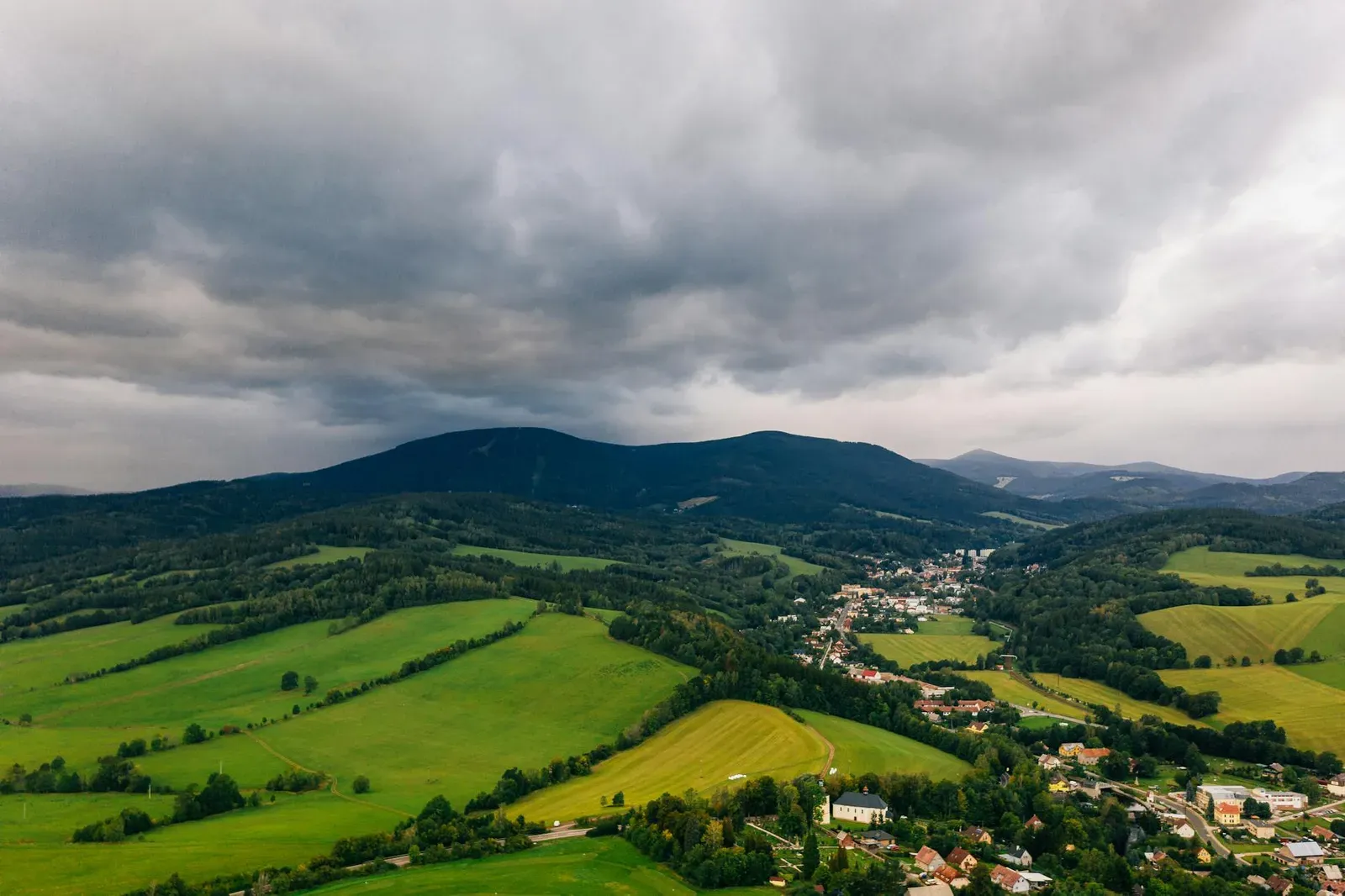
This range sits hard against the Polish border, completely ignoring the tourist traffic of the Krkonoše to the north. They lack the altitude for massive ski resorts. You travel here to look at a landscape defined by 1930s artillery bunkers and rural industries that refuse to die quietly.
The 1938 Concrete Line
The hike up to the Hanička fortress feels like a simple forest walk until you realize what sits under your boots. The ground is firm, but miles of artillery chambers and supply tunnels run directly beneath the tree roots. Czechoslovakia poured an impossible amount of money and concrete into this border in the 1930s.
I met Pavel sitting on a damp log near a bunker entrance. He wore a heavy wool sweater. His hands looked like they had spent sixty years splitting firewood. We sat looking at a grey dome of concrete that surfaced from the moss. The air around us carried that same thick scent of wet spruce.
"My grandfather hauled sand for this," Pavel said, nodding at the bunker. "They sweated blood building a shield against the Germans. Then politicians signed the Munich Agreement in 1938 and handed the keys over without firing a shot."
The Orlické Mountains were squarely in the Sudetenland. After the war, the ethnic Germans were expelled on trains. New settlers moved into the empty houses, trying to farm a rocky landscape they did not understand. Pavel's family was one of the few with deep roots that stayed. The region survives only because of the stubbornness of the people who refused to leave.
Fire, Quartz, and Stubbornness
I drove the winding road down into the Deštné valley to find the industry that kept this region alive before the bunkers. A column of thick coal smoke rose from a plain wooden shed, pulling that familiar winter scent back into the car. This was a glassblowing studio, one of the few still operating in the traditional way.
The heat inside hit like a physical punch. A glassblower in a sweat-stained shirt pulled a molten orange mass from the furnace. He turned the metal pipe with mechanical precision, blowing until the glass expanded.
"In the 18th century, Orlické glass shipped all over Europe," he said. He kept his eyes entirely on the glowing mass. "The mountains provided the three things we needed. Wood to burn, quartz in the dirt, and water in the streams."
The massive factory operations are long dead, outcompeted and abandoned. But the physical memory of the work remains. In a place where the thin topsoil makes farming a miserable existence, the glass masters brought money and a reason to stay. He handed me a finished piece, a heavy, clear glass eagle. It was cold and substantial, a direct product of the mountain's raw materials and 1,200 degrees of fire.
The Ridge That Divides Nothing
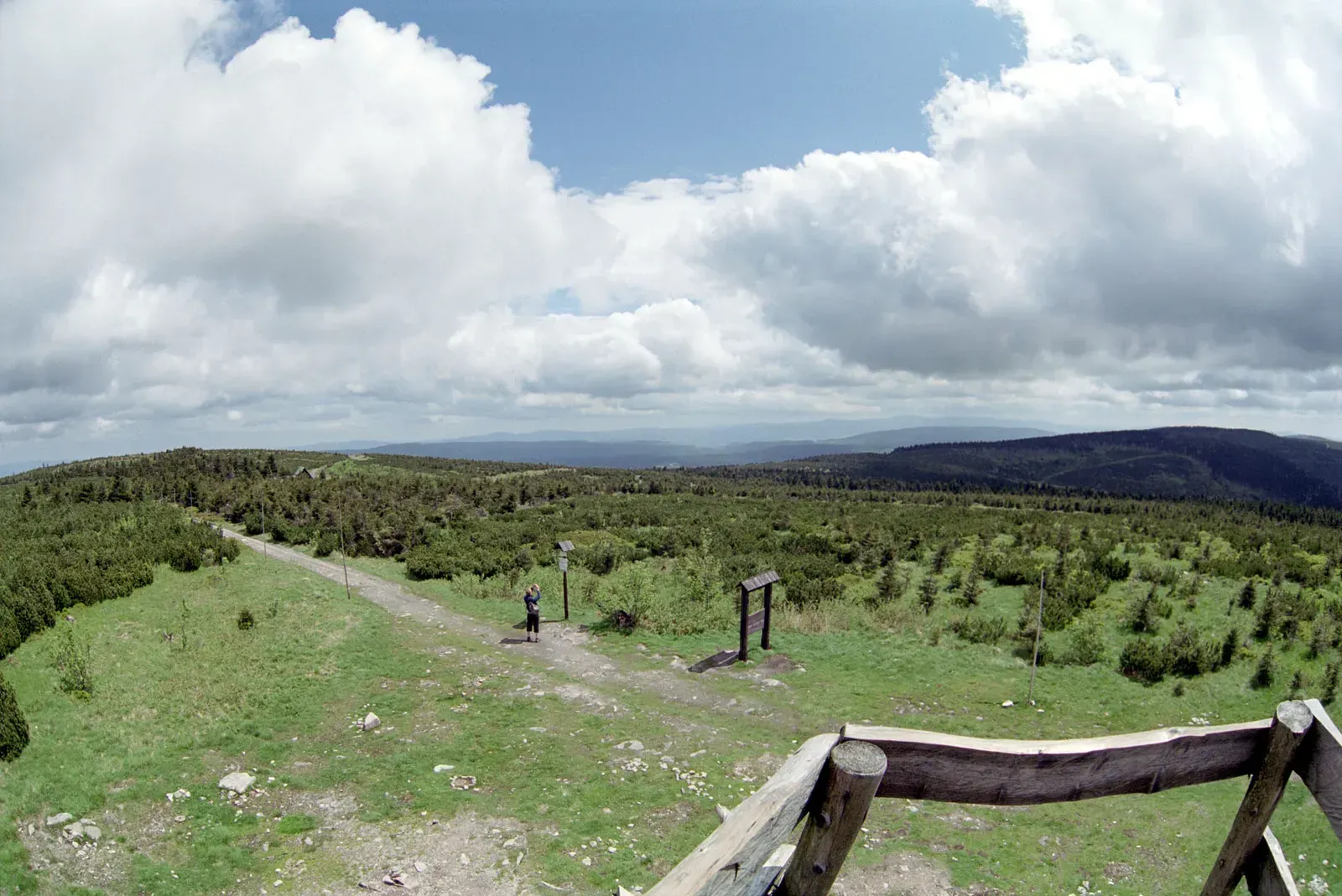
I woke up early the next morning to walk the Hřebenovka, the main ridge trail. Fog stuck to the valley floor. I wanted to reach Velká Deštná, the highest peak in the range at 1,115 meters.
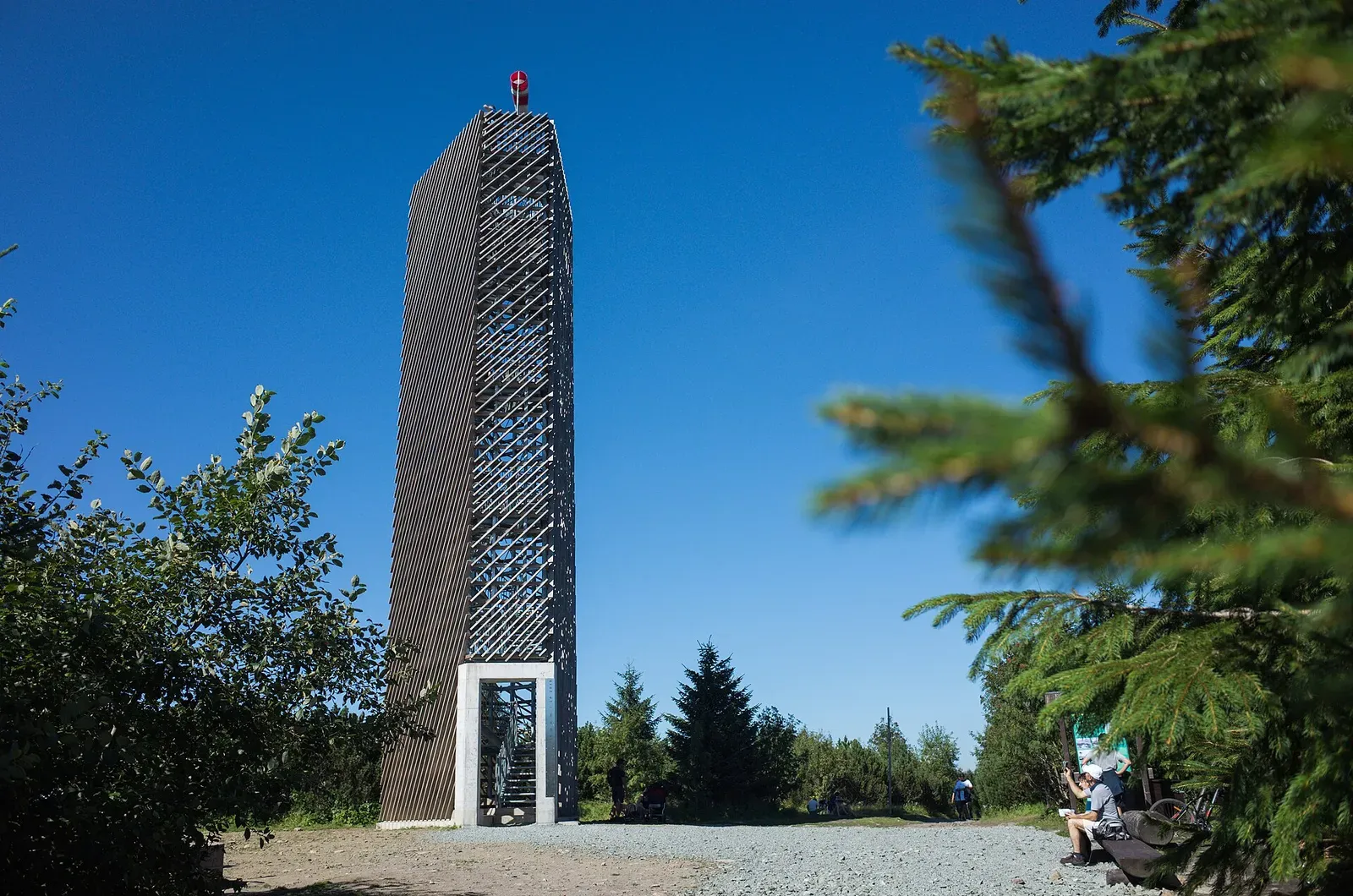
The climb is not technically difficult. The wind picks up exactly when the thick spruce forest gives way to bare clearings, stripping away the scent of coal smoke and leaving only the sharp chill of altitude. You do not climb the Orlické Mountains for sheer vertical drops. You climb them for the sightlines. I walked up the modern wooden observation tower at the summit. The Czech hills rolled out to my left, while the steep drops of Poland's Kłodzko Valley fell away to my right.
Up on the metal grating, the border is a technicality. The freezing wind blasts straight out of Poland without asking for a passport. I found two Polish hikers at the top trying to light a cigarette. We shared half a block of chocolate and communicated in a butchered mix of Czech, Polish, and hand gestures. We were unified mostly by how cold our faces were.
Garlic Soup and the Winter Spirit
I stopped at a wooden mountain hut to eat a bowl of česnečka, a garlic soup thick with melted cheese and croutons. It is designed specifically to repair whatever the wind just did to you. I asked the woman behind the bar about Rampuškák.
"You know about him?" she asked. She dropped a stack of cardboard coasters on the counter.
The Krkonoše mountains have Krakonoš, a giant who guards the hills. The Orlické Mountains split the job in two. Kačenka handles the summer. Rampuškák is the rougher spirit who shows up with the ice.
"Rampuškák brings the winter," she said, pouring a half-liter of Kofola. "He drops the blizzards that bury our roads. But we need him. Without his snow, there is no spring melt for the rivers. You don't mess around on the ridge when he arrives."
She wasn't talking about fairy tales. This is how you explain living in a place that can freeze you to death if you make a stupid decision in January. The Catholic crosses on the trails sit right next to a deep, practical respect for what the weather can do.
The Church with the Glass Roof
Before leaving, I drove to the village of Neratov. If you want proof of how stubborn this region is, look at the Church of the Assumption. The building was gutted after World War II. The roof caved in. The state planned to demolish the ruins. Instead, decades later, a local priest and a few residents decided to fix it. They did not build a standard slate roof. They covered the massive stone nave entirely in glass.
I stood inside and looked straight up through the ceiling at the grey November sky. Rain hit the glass directly over the altar. The air in the sanctuary was cold, carrying a faint draft of wet spruce from the forest outside.
This is exactly how the Orlické Mountains operate. They take destruction, combine it with the local glassmaking history, and build something highly specific. Thirty years ago, Neratov was practically a ghost town. Today, it operates a cooperative that employs people with disabilities, a pub, and a guesthouse.
Why Bother Coming Here
I threw my bag into the trunk of the car. I had no list of major landmarks to cross off, because there aren't any. The Orlické Mountains force a slower pace. They make you pay attention to the grit of the concrete tunnels, the blast of the glass furnace, and the heavy garlic in your soup.
If you drive up here, spend money at the independent huts. Buy a heavy glass paperweight from a guy sweating in a shed. Walk where the trail markers tell you to walk, because the peat bogs will swallow your boots if you don't. Acknowledge that you are just a temporary visitor in Rampuškák's territory. Leave when the wind tells you it's time.
Jan's Pro-Tip: The Yellow Map
Do not trust your phone on these trails. The cell coverage drops entirely the second you walk down into a ravine. Before you hike, go into a local tobacco shop and buy the yellow KČT (Klub českých turistů) paper map, specifically number 26 for the Orlické Mountains. Put it in a plastic bag so the rain doesn't ruin it. It tracks every single painted tree marker and mountain hut. You will actually need it.